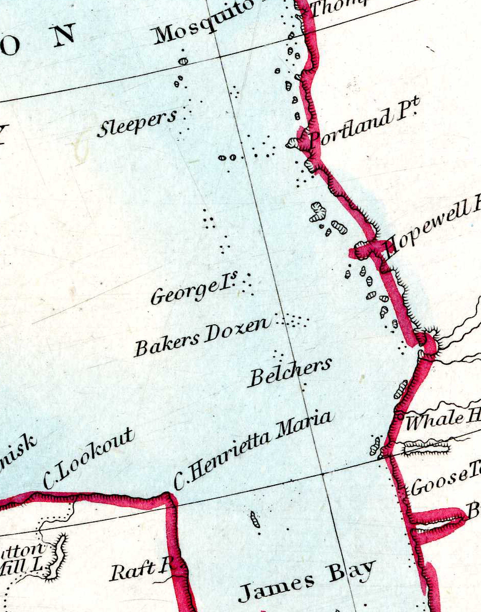
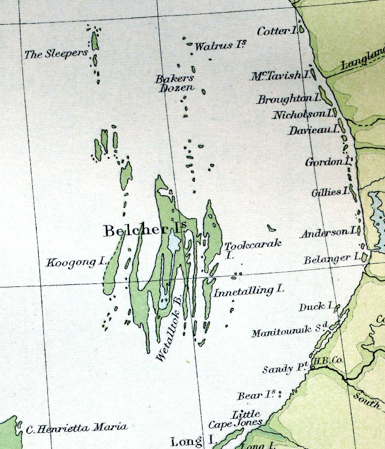
 1873 S.D.U.K. Atlas
The Belcher Islands are in Hudson's Bay. They form part of Nunavut, though they are closer to Quebec than to most of Nunavut. This page shows how they have been represented in atlases at various dates.
You can click on any of the maps to see a larger and more detailed version. The versions on this page are all at approximately the same scale.
Though they are shown as specks on maps from the nineteenth century, the Belcher Islands were only "discovered" in 1914, by Robert Flaherty, using a map drawn by George Weetaltuk.
1873 S.D.U.K. Atlas
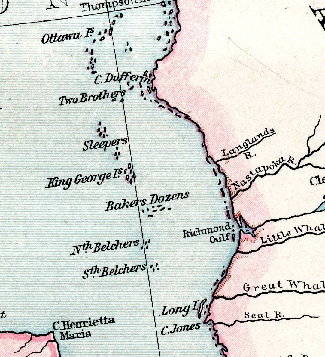 1893 Cassell's Atlas (derived from Andree's)
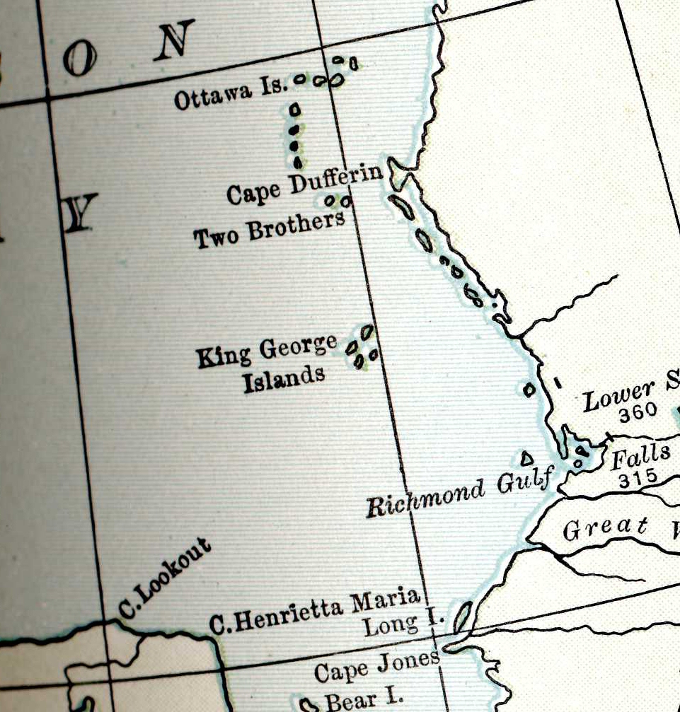 1903 Encyclopedia Britannica Atlas
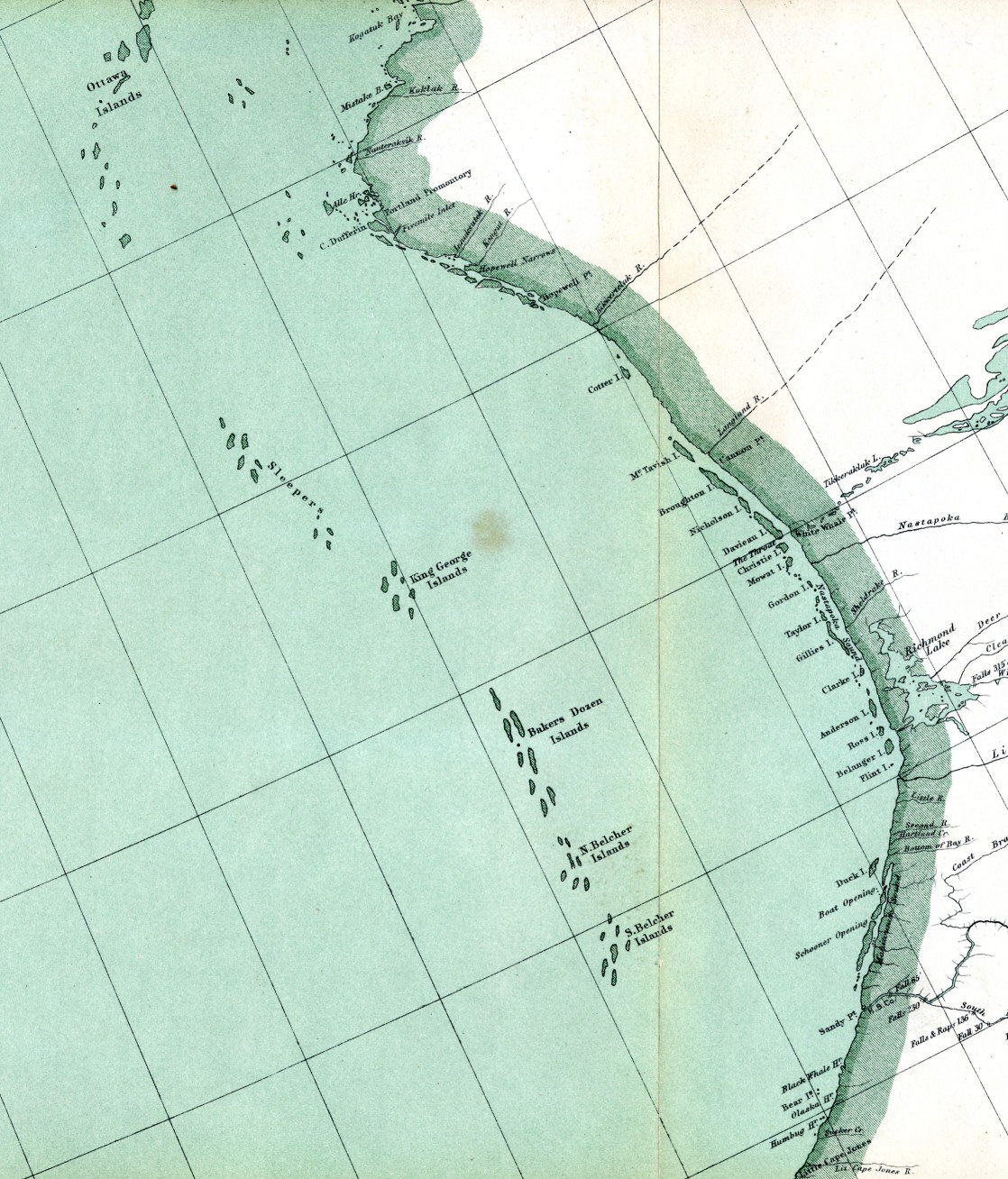 1906 "Dominion of Canada 3" map in slip case
 1920 Times Atlas
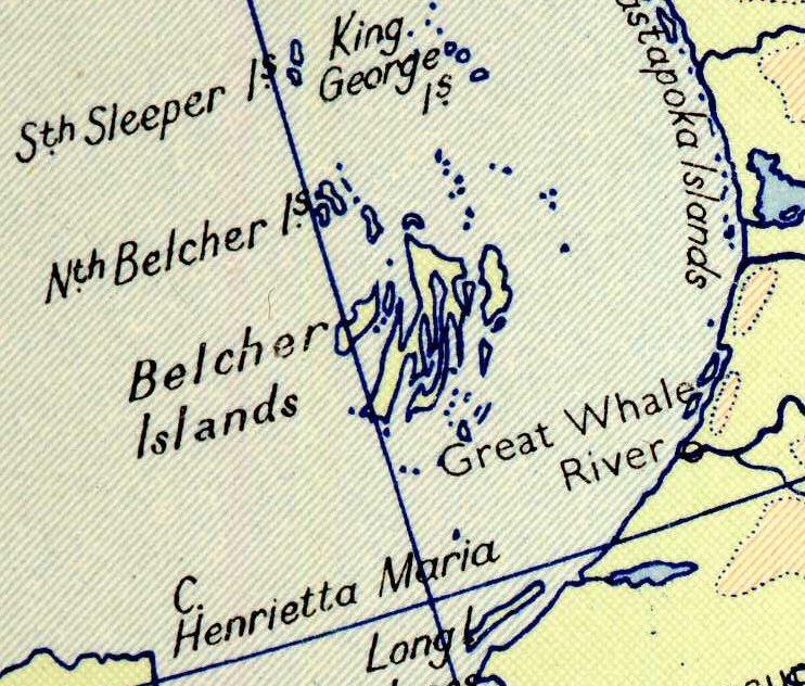 1957 Times Atlas
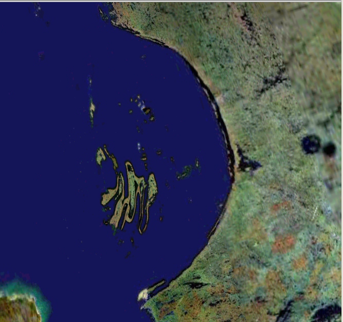 2005 Google Earth
Other pages showing how maps have changed due to more accurate information.